
Finding Who Lives on a Logan Street
The street directory workflow begins with a location, not a person. Put the known address into the USPS address path or AIS viewer to check its delivery form. Then use Cache GIS to identify the mapped parcel and CORE to compare the tax record. These steps can expose a parcel number, owner field, mailing line, situs address, tax district, or legal description.
From there, a street directory researcher can move to the Cache Recorder for recorded documents, the county election office for the lawful public portion of voter data, and Logan’s historical collections for older occupants. The order matters. A mailing address is not proof that an owner lives at the property, and a historical street entry is not a current resident record.
- Verify the postal address with the USPS AIS Viewer.
- Search Logan or Cache GIS by address or tax ID and note the parcel card fields.
- Run CORE by house number, street, city, or partial parcel value.
- Use the Recorder index or a specific records request for deed and plat details.
- Compare a dated voter, directory, or map source only for the narrow research purpose.
A current block question belongs in the Logan neighbors workflow. A past household question belongs in the city directory or previous-residents trail, where dates stay visible.
To illustrate the postal step, the USPS AIS Viewer is the official address and delivery-type fallback for a Logan mailing address.
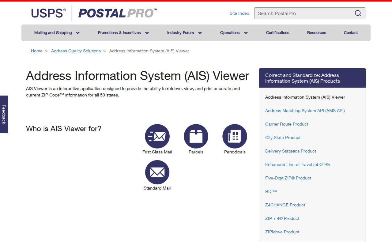
The image shows why postal validation and parcel validation are separate jobs in a Logan street directory search.
Logan Records Searchable by Street
Several records can be reached with an address, but they do not all describe the same relationship. The Cache Assessor stores tax characteristics. GIS maps the parcel and layers around it. The Recorder keeps documents and ownership plats. A voter record uses a registration address. A permit record names an issuing municipality and may be delayed or incomplete. This table keeps the sources distinct.
| Record set | Keeper | Street-level signal | Access |
|---|---|---|---|
| Property / tax roll | Cache Assessor and CORE | Parcel, owner field, mailing and situs lines, tax year | Public CORE search; limits apply |
| GIS parcel map | Cache GIS | Parcel geometry, layers, tax district, legal description | Free viewer |
| Deeds and plats | Cache Recorder | Recorded parties, entry, book/page or image when available | Inspection or copy fee |
| Voter information | Cache Clerk / Utah election sources | Public registration fields where allowed | Privacy rules apply |
| Permits | Logan City or correct municipality | Project, address, permit and issuing agency | Request route; state list fallback |
The parcel key is the bridge between the first three rows. It does not turn every other row into ownership proof. Use the issuing municipality for permits. Cache Building Division expressly does not issue Logan City permits, so a county search can be the wrong door for a Logan project.
CORE Address Fields in Logan
CORE’s public form shows House Number, Street, City, Tax Year, Parcel, Last Name or Business Name, First Name, and Legal Description. The star-marked fields support partial matching. The form’s examples include an E 100 N search in Logan, a partial parcel such as 01-001, and a Fish & Game name. Not all fields need to be filled, which makes a broad street pass possible before the parcel is known.
| Field | Reading it without overclaiming |
|---|---|
| House number and street | Finds address-shaped parcel records; old numbers may differ. |
| City | Narrows the form, but does not replace a municipal boundary check. |
| Parcel | Tax identifier that can connect GIS, CORE, and Property Watch. |
| Legal description | Deed or parcel wording that can outlast a street label. |
| Name | May return an owner or business field, not a verified occupant. |
The public search is listed at $0 per month with a 100-parcel-per-day limit and basic tax information. Images and abstracts are associated with a paid subscriber tier, observed at $80 per month, while bulk requests are separately quoted. CORE says its public data is representational rather than authoritative. Confirm the current label before paying, and use the Recorder for a document copy.
- Parcel
- A mapped property unit with a county tax identifier.
- Situs address
- The address for the physical property being assessed, distinct from a mailing address.
- Plat
- A recorded map that lays out parcels, dimensions, or lots.
- Criss-cross directory
- A reverse directory arranged by street or address instead of only by surname.
Mailing, Situs, and ZIP Fields
Cache’s valuation notice fields include ownership, parcel number, tax area, last review date, mailing address, property situs address, and legal description. A Logan street directory should label these lines exactly. The mailing address is for correspondence. The situs address is the mapped property. A ZIP routes mail. None of those labels alone identifies a present household.
Logan’s ZIP labels in the Utah state list are 84321, 84322, 84323, and 84341. The list pairs postal cities with ZIPs, not city limits. North Logan office context appears with 84341, which is one reason a city label should not decide the record custodian. Use USPS AIS for delivery formatting, Utah ZIP-area GIS for a dated polygon, and Cache GIS for the parcel.
Note: No official table maps every Logan street or ZIP+4 to municipal limits, so exact addresses need USPS and current local GIS checks.
Historical Street Evidence in Logan
House numbers and street names can change. Logan Library’s house-history guide tells researchers to compare old maps and directories when a modern address does not match. The Utah City Directories collection has Logan material observed from 1913–14 through 1988, including street sections in R.L. Polk volumes. A directory’s street listing is a dated source. It may show a householder, business, occupation, or telephone entry for that edition.
The Library of Congress holds 19 Logan Sanborn sheets from September 1900. A USU 1930 sheet shows the street grid and landmarks such as Wilson School and the Logan 7th Ward meeting house. Sanborn maps describe structures, materials, and block context. They do not show today’s owner or resident. When a street search reaches backward, preserve the map year, directory year, and present parcel ID side by side.
Walking the Cache GIS Street Grid
Cache GIS offers more than a parcel outline. The map menu includes voting and precinct layers, floodplain, surveys and section corners, original 1800s surveys, historical roads and parcels, 1974 aerial imagery, development by decade, and house-number tools. Pan along a street to understand the parcel sequence, then open each relevant card. This is a useful way to spot a lot split, an old road line, or a name that needs a Recorder check.
The viewer is changing. The county says it is moving from ArcGIS Web AppBuilder to Experience Builder, with legacy maintenance planned for Q4 2026 and a retirement target in Q2 2027. Record the retrieval date and the viewer generation in notes. A map layer can change without changing a deed, and a current map can still lack the historical street label that explains an old directory entry.
Deed Trails Along a Logan Street
The Cache Recorder maintains land-title documents and an index, and its ownership plats show parcels, current record owner, dimensions, tax ID, and acreage. Recorded documents are open for inspection under county rules. CORE is the observed online entry point, but no separate public grantor-grantee form was located in the research. Do not call a CORE result a title search.
For a street question, note the parcel ID first. Then compare the owner field with a recorded document, read the legal description, and follow the dated entries that fit the parcel. Recorder staff can explain the index and locate documents, but they do not give title or boundary advice, prepare documents, or promise that old pages are digitized. Copies use a fee that should be confirmed with the office.
Permits and Address Records
Permit research begins with the boundary. Logan City issues its own permits. Cache Building Division covers unincorporated areas and named smaller municipalities, but explicitly excludes Logan City. The visible Logan portal has an “Enter Permit Name” box, Search, and Filter controls, with examples of Adams Residential Permit 2025–2026 and Hillcrest Residential Permit 2025–2026. Research inspection found a parking or residential transaction route, not a complete Logan building-permit index.
Utah’s statewide building-permit list is the fallback for a data request. It accepts ZIP codes, original permit dates, and dates sent to the state. Results may include owner and contractor names and addresses, property address, permit number, issuing municipality, project cost, and phone if supplied. The state notes incomplete local submissions and a two-to-four-week delay. Ask Logan Community Development for current city records.
What a Logan Street Directory Cannot Show
Address records can describe a parcel, owner, filing party, voter registration, or past householder. They do not establish that a person currently lives at the address, that an owner occupies it, or that a street is safe for contact. Renters and other household members may not appear in public sources. Vehicle-address data is restricted, and utility customer lists are not a public resident index.
Use the address trail lawfully. Utah’s stalking law addresses repeated conduct that causes reasonable fear or emotional distress. Do not use Logan street records to stalk, harass, intimidate, threaten, dox, or publish a protected address. If a record is wrong, ask its custodian for the correction route.
A street directory is strongest when it states the source and date: “property mailing field from CORE,” “situs shown in GIS,” or “householder entry in a 1974 directory.” That wording respects the difference between a record and a conclusion.